Slovakia Today
If we look at the map of Europe, we find out that Slovakia is located directly in its center. After all, geographical center of Europe is located in Slovakia – near the historical mining town Kremnica.
Geographical Location
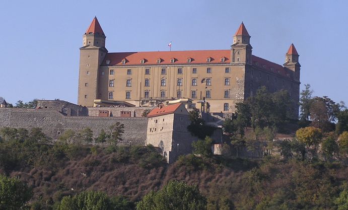
Slovakia is situated in the Central Europe, almost in the “heart” of Europe. It is neighboring with following countries: Poland on the North, Ukraine on the East, Hungary on the South, Austria on the South-West, and the Czech Republic on the West. Slovakia is divided into eight regions: Trnava, Nitra, Žilina, Banská Bystrica, Prešov, Trenčín, and Košice region. Regions are named according the central towns in every region. Bratislava is the capitol of Slovakia. The estimation is that there is more than 7 000 settlements in Slovakia integrated into 2834 towns and villages.
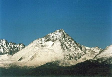
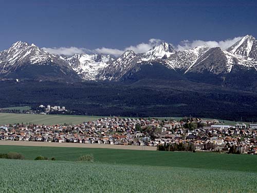
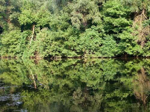
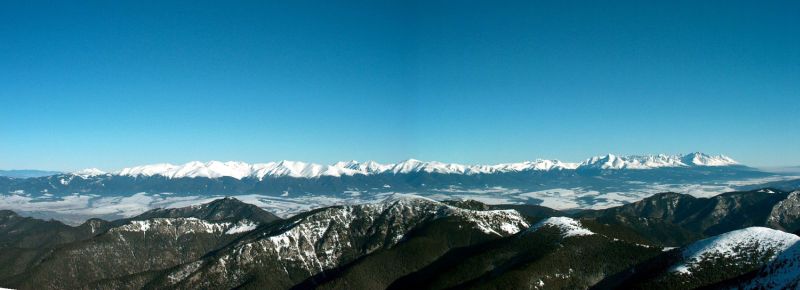
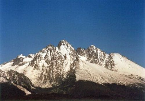
Geographic surface of Slovakia belongs to Carpathian Mountains. In Slovakia, there is the largest part of Western and part of Eastern Carpathian Mountains located. Lowlands takes 40 % and highlands 60 % of the surface. The lowest geographical point is located in Bodrog (94 m above sea level) near the Slovak-Hungarian border, and the highest point is located on Gerlach´s Peak (2 655 m above sea level).
![]()
The climate of our republic is affected by the fact that it is situated in Northern moderate climate, where there are four season changing. Individual elements of the climate in Slovakia are influenced primarily by height above the sea level.
Industry is the most important part of the national economy of the Slovak republic. At the end of 19-th century, there was a boom of chemistry industry as well. In Bratislava - town situated on the river Danube and thanks to that easily approachable for import of raw material – oil refinery (Apollo) and production of dynamite was placed. Industrialization and strong development of railway transport conditioned the establishment of machine industries. The largest one of them was the railway service station in Vrútky. .
Factories of machine industry are located in every region of Slovakia. Their biggest concentration is in area situated around the middle of the river Váh (Trenčín, Dubnica nad Váhom, Považská Bystrica, Žilina, Martin) but also elsewhere. Transport machine industry is very important in Slovakia. Cars and their components are produced in Bratislava, Trnava, Bánovce nad Bebravou motorcycles in Považská Bystrica and Kolárovo, river-boats in Komárno, and railway wagon repair shops in Poprad and Trnava. Production of bearings is located in factories in Považská Bystrica, Žilina, Kysucké Nové Mesto, Skalica, and Prešov. Electro-technical production is focused on connection technology (Liptovský Hrádok, Stropkov, Vráble), TV sets (Nižná na Orave), washing machines (Matejovce near Poprad), refrigerators (Zlaté Moravce), lamps (Nové Zámky). In addition to this, we can also mention production of health technology (Stará Turá, Piešťany), armatures (Myjava), iron constructions (Brezno), agricultural machinery (Snina). Metallurgical industry and metal exploitation has its tradition in Slovakia since the Middle Ages.
In Slovakia, salt, black coal, brown coal, iron-stone, mercury, magnetite, and other stock are exploited. They have different functions such as – salt is important for food production, black coal is used for railway industry and mercury for measuring temperature – of body or air.
![]()
Population
Slovakia has approximately 5 420 000 inhabitants. The level of literacy is not documented. Problems with educations are related primarily to Roma people living in Eastern Slovakia. The major nationality in Slovakia is Slovak with 85 % of population. Small representations have also ethnical groups of Czechs, Moravians, Germans, Poles, and Ruthenians. Slovakia is considered to be a Christian country as Christianity has a long tradition and became an integral part of the history of Slovakia.- National distribution of the population: Slovak nationality (85,8 %), Hungarian nationality (9,7 %), Roma nationality (1,7 %), Czech nationality (0,8 %), Ruthenian nationality, Ukrainian, Russian, German, Polish, and others (2 %)
- Distribution of Population according Religion believers (84,1 %) out of which: Roman-Catholic (68,9 %), Evangelic (6,9 %), Greco-Catholic (4,1 %), reformed Christian (2 %), not specified (2,2 %), without denomination (13,7 %)
The Most… in Slovakia (kliknutím zobrazíte foto)
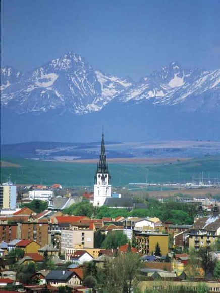
The highest location: Gerlach´s Peak, 2 655 m above sea level
The lowest location: surface of the river Bodrog, 94 m above sea level
The highest Church Tower: Spišská Nová Ves (87 m)
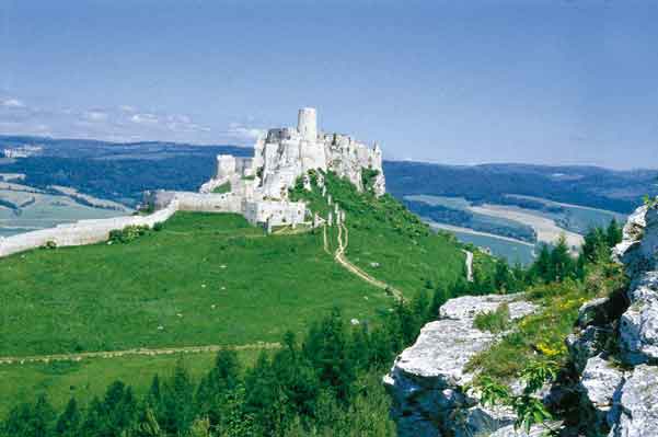
The largest one out of 170 castles: Spiš Castle
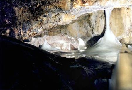
The oldest ice cave in Europe: Dobšinská ľadová jaskyňa
The village situated in the highest location: Štrbské Pleso, 1355 m above sea level
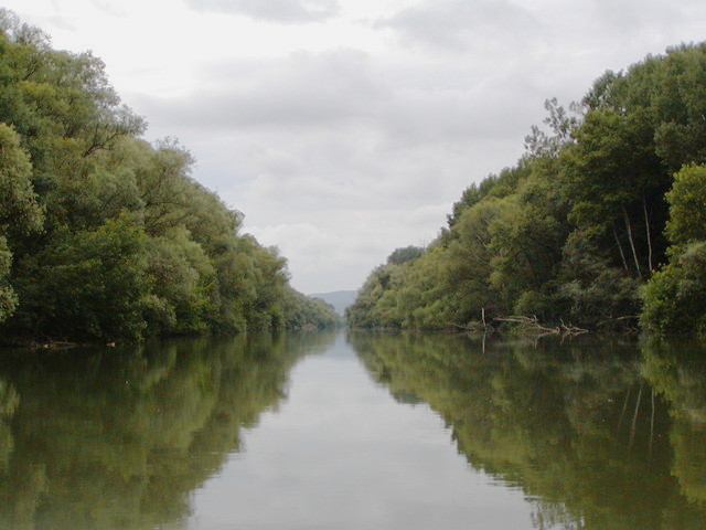
The largest river island in Europe: Žitný ostrov in Southern Slovakia, 132 612 ha
The largest natural park: National Park Low Tatras, 81 000 ha
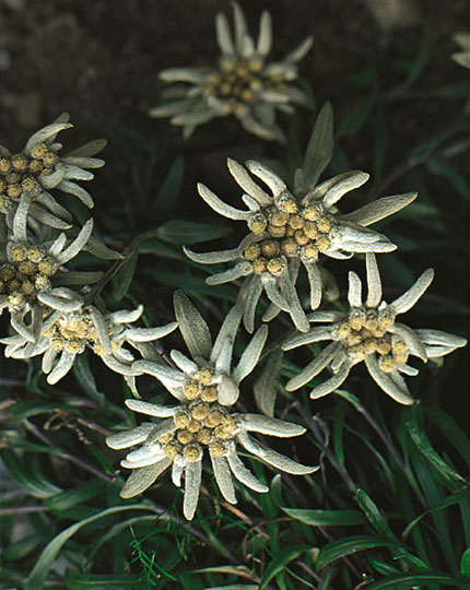
The oldest protected plant: edelweiss
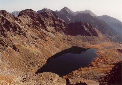
The largest and deepest lake in Slovakia: Veľké Hincovo Pleso – 20.1 ha, depth 53 m
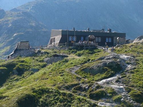
Place with the biggest average annual rainfall: Zbojnícka chata (1960 m above sea level) – 2 130 mm
The first printed book: Latin textbook by Lucas Fabinus, 1573 in Prešov
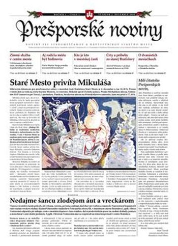
First newspapers: Prešporské noviny, July 1783 in Pressburg (Bratislava)